IMAGES TAKEN NEAR TO
Brangwyn Gardens, BEDFORD, MK41 7NJ
Introduction
This page details the photographs taken nearby to Brangwyn Gardens, MK41 7NJ by members of the Geograph project.
The Geograph project started in 2005 with the aim of publishing, organising and preserving representative images for every square kilometre of Great Britain, Ireland and the Isle of Man.

There are currently over 7.5m images from over14,400 individuals and you can help contribute to the project by visiting https://www.geograph.org.uk
Image Map
Images are licensed for reuse under creativecommons.org/licenses/by-sa/2.0
Notes
- Clicking on the map will re-center to the selected point.
- The higher the marker number, the further away the image location is from the centre of the postcode.
Image Listing (58 Images Found)
Images are licensed for reuse under creativecommons.org/licenses/by-sa/2.0
Image
Details
Distance
10
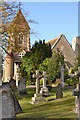
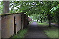
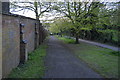
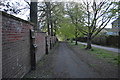
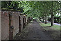
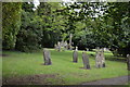
Bedford Cemetery Chapel.
This is the chapel of the old town cemetery. I think the cemetery was in use from the 1800s to 1980s
Image: © Dennis simpson
Taken: 25 Oct 2011
0.09 miles