IMAGES TAKEN NEAR TO
Fairhill, BEDFORD, MK41 7FY
Introduction
This page details the photographs taken nearby to Fairhill, MK41 7FY by members of the Geograph project.
The Geograph project started in 2005 with the aim of publishing, organising and preserving representative images for every square kilometre of Great Britain, Ireland and the Isle of Man.

There are currently over 7.5m images from over14,400 individuals and you can help contribute to the project by visiting https://www.geograph.org.uk
Image Map
Images are licensed for reuse under creativecommons.org/licenses/by-sa/2.0
Notes
- Clicking on the map will re-center to the selected point.
- The higher the marker number, the further away the image location is from the centre of the postcode.
Image Listing (19 Images Found)
Images are licensed for reuse under creativecommons.org/licenses/by-sa/2.0
Image
Details
Distance
2
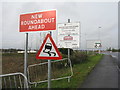
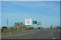
Road signs on the A6
At the junction of what will be the Bedford Western Bypass - Northern Section with the existing A6 on the northern outskirts of Bedford. The 'new roundabout' has been there since at least 2003!
Image: © M J Richardson
Taken: 14 Nov 2015
0.02 miles
3
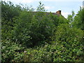
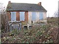
The undergrowth is really taking over
A derelict pair of houses on Clapham Road in Bedford. Earlier photos Image and Image show some neglect and abandonment, but one year after the last photo the house is almost invisible as a result of the growth of ash seedlings and other vegetation.
Image: © M J Richardson
Taken: 14 Jun 2011
0.03 miles
6
Houses disappearing into the undergrowth
A semi-detached pair on the A6 Clapham Road, Bedford, with a date stone of 1898 over the doorway. Move ahead seven years and one gets Image
Image: © M J Richardson
Taken: 5 Dec 2008
0.04 miles
7
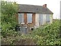
Still crumbling
Not much more deterioration since the earlier photograph, taken in December 2008 Image
Image: © M J Richardson
Taken: 27 Apr 2010
0.04 miles

9
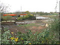
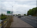
The houses have gone!
The unloved and decaying semi-detached pair of houses depicted on earlier occasions Image, from the same spot, has finally succumbed to the road builders - the area is being redeveloped as part of the Bedford Western Bypass - Northern Section Image
Image: © M J Richardson
Taken: 14 Nov 2015
0.07 miles
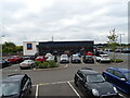
10
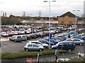
Sainsbury's at Clapham Road, Bedford
Image: © M J Richardson
Taken: 5 Dec 2008
0.09 miles