IMAGES TAKEN NEAR TO
Wilden Road, BEDFORD, MK41 0JJ
Introduction
This page details the photographs taken nearby to Wilden Road, MK41 0JJ by members of the Geograph project.
The Geograph project started in 2005 with the aim of publishing, organising and preserving representative images for every square kilometre of Great Britain, Ireland and the Isle of Man.

There are currently over 7.5m images from over14,400 individuals and you can help contribute to the project by visiting https://www.geograph.org.uk
Image Map
Images are licensed for reuse under creativecommons.org/licenses/by-sa/2.0
Notes
- Clicking on the map will re-center to the selected point.
- The higher the marker number, the further away the image location is from the centre of the postcode.
Image Listing (7 Images Found)
Images are licensed for reuse under creativecommons.org/licenses/by-sa/2.0
Image
Details
Distance
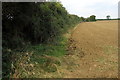
1
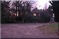
House in the woods
On Wilden Road near Salph End
Image: © David Howard
Taken: 30 Jan 2022
0.06 miles
5
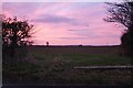
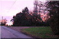
Sunset by Wilden Road
Every sky was different so I took as many as I could.
Image: © David Howard
Taken: 30 Jan 2022
0.13 miles
6
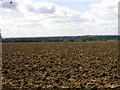
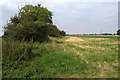
Freshly Ploughed Field
Parts of Bedford are shown in the distance.
Image: © Kokai
Taken: 7 Aug 2005
0.16 miles