IMAGES TAKEN NEAR TO
Stratford Road, MILTON KEYNES, MK19 6DE
Introduction
This page details the photographs taken nearby to Stratford Road, MK19 6DE by members of the Geograph project.
The Geograph project started in 2005 with the aim of publishing, organising and preserving representative images for every square kilometre of Great Britain, Ireland and the Isle of Man.

There are currently over 7.5m images from over14,400 individuals and you can help contribute to the project by visiting https://www.geograph.org.uk
Image Map
Images are licensed for reuse under creativecommons.org/licenses/by-sa/2.0
Notes
- Clicking on the map will re-center to the selected point.
- The higher the marker number, the further away the image location is from the centre of the postcode.
Image Listing (12 Images Found)
Images are licensed for reuse under creativecommons.org/licenses/by-sa/2.0
Image
Details
Distance
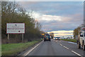
1
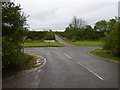
Road junction with A422 at Cranley Oak
Image: © Phil Catterall
Taken: 6 Oct 2006
0.04 miles

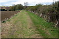
4
Aylesbury Vale : Track
A track off the A422.
Image: © Lewis Clarke
Taken: 18 Mar 2019
0.07 miles
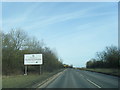
5

A422 Buckinghamshire & Northamptonshire Border
Image: © Stuart Logan
Taken: 29 Mar 2014
0.07 miles
6
South Northamptonshire : The A422
Entering Northamptonshire on the A422.
Image: © Lewis Clarke
Taken: 18 Mar 2019
0.08 miles
7
A422 at Northamptonshire county boundary
Image: © Colin Pyle
Taken: 29 Feb 2016
0.09 miles
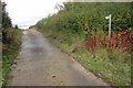
8
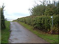
Public Footpath to Leckhampstead
This footpath runs from the A422 Junction to Thornton towards Leckhampstead South End via Limes End Farm.
Image: © Mr Biz
Taken: 16 Oct 2010
0.12 miles
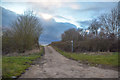
9

Lane heading to Thornton
From the A422 the lane heading to Thornton
Image: © Shaun Ferguson
Taken: 21 May 2010
0.15 miles