IMAGES TAKEN NEAR TO
Weavers Close, BUCKINGHAM, MK18 7RP
Introduction
This page details the photographs taken nearby to Weavers Close, MK18 7RP by members of the Geograph project.
The Geograph project started in 2005 with the aim of publishing, organising and preserving representative images for every square kilometre of Great Britain, Ireland and the Isle of Man.

There are currently over 7.5m images from over14,400 individuals and you can help contribute to the project by visiting https://www.geograph.org.uk
Image Map
Images are licensed for reuse under creativecommons.org/licenses/by-sa/2.0
Notes
- Clicking on the map will re-center to the selected point.
- The higher the marker number, the further away the image location is from the centre of the postcode.
Image Listing (13 Images Found)
Images are licensed for reuse under creativecommons.org/licenses/by-sa/2.0
Image
Details
Distance
2
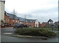
Playground on Needlepin Way, Buckingham
Image: © David Howard
Taken: 4 Feb 2018
0.05 miles
5
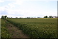
Fields by Benthill Farm
The Bernwood Way passing Benthill Farm
Image: © Shaun Ferguson
Taken: 7 Jul 2007
0.15 miles
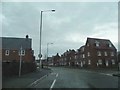
6
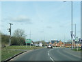
A413 London Road at Buckingham town boundary
Image: © Colin Pyle
Taken: 29 Feb 2016
0.18 miles
7
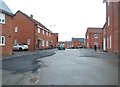
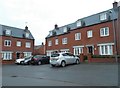
Threads Lane, Buckingham
It looks like they haven't finished this estate, and can't believe they'd have left the road in this condition otherwise.
Image: © David Howard
Taken: 4 Feb 2018
0.19 miles
8
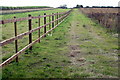
Bernwood Jubilee Way
The Bernwood Jubilee Way is a 61mile trail cutting across 27 parishes, the path links together sections of the rights of way network to give access to this forgotten hunting forest.
Image: © Philip Jeffrey
Taken: 4 Oct 2012
0.20 miles
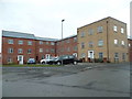
9
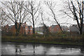
Housing development off Pillow Way
It is always a major step when housing expansion crosses the outer ring road. There is now a lot of it on former greenfield sites south of the A421. This is viewed across the A421 in rain.
Image: © Bill Boaden
Taken: 24 Nov 2018
0.21 miles
10
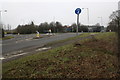
Roundabout on A413 (London Road) at Tesco
The milestone (middle right of photo) Image shows mile distances to Buckingham 1, Brackley 9, Banbury 18; London 56, Aylesbury 16, Winslow 5.
Image: © Roger Templeman
Taken: 17 Feb 2011
0.21 miles