IMAGES TAKEN NEAR TO
Weir Lane, BUCKINGHAM, MK18 2NF
Introduction
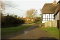
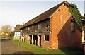
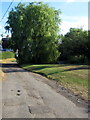
This page details the photographs taken nearby to Weir Lane, MK18 2NF by members of the Geograph project.
The Geograph project started in 2005 with the aim of publishing, organising and preserving representative images for every square kilometre of Great Britain, Ireland and the Isle of Man.

There are currently over 7.5m images from over14,400 individuals and you can help contribute to the project by visiting https://www.geograph.org.uk
Image Map
Images are licensed for reuse under creativecommons.org/licenses/by-sa/2.0
Notes
- Clicking on the map will re-center to the selected point.
- The higher the marker number, the further away the image location is from the centre of the postcode.
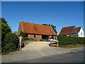
Image Listing (19 Images Found)
Images are licensed for reuse under creativecommons.org/licenses/by-sa/2.0
Image
Details
Distance
10
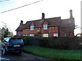
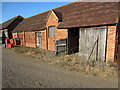
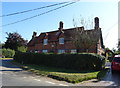
Cottages, Botolph Clayden
Dated 1939 (yellow stone plaque in the centre of first floor). See http://www.britishlistedbuildings.co.uk/en-396747-1-and-3-orchard-way-east-claydon-bucking for entry in British Listed Buildings
Image: © Bikeboy
Taken: 2 Jan 2015
0.08 miles