IMAGES TAKEN NEAR TO
Tingrith, MILTON KEYNES, MK17 9EG
Introduction
This page details the photographs taken nearby to MK17 9EG by members of the Geograph project.
The Geograph project started in 2005 with the aim of publishing, organising and preserving representative images for every square kilometre of Great Britain, Ireland and the Isle of Man.

There are currently over 7.5m images from over14,400 individuals and you can help contribute to the project by visiting https://www.geograph.org.uk
Image Map
Images are licensed for reuse under creativecommons.org/licenses/by-sa/2.0
Notes
- Clicking on the map will re-center to the selected point.
- The higher the marker number, the further away the image location is from the centre of the postcode.
Image Listing (6 Images Found)
Images are licensed for reuse under creativecommons.org/licenses/by-sa/2.0
Image
Details
Distance
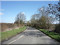
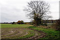
3
Minor road junction west of Tingrith
Looking west.
Image: © JThomas
Taken: 25 Mar 2016
0.19 miles
6
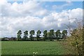
Trees feeling the force of the wind
strong winds blowing from left to right
Image: © Dennis simpson
Taken: 12 May 2006
0.24 miles