IMAGES TAKEN NEAR TO
Payne Road, MK17 8EX
Introduction
This page details the photographs taken nearby to Payne Road, MK17 8EX by members of the Geograph project.
The Geograph project started in 2005 with the aim of publishing, organising and preserving representative images for every square kilometre of Great Britain, Ireland and the Isle of Man.

There are currently over 7.5m images from over14,400 individuals and you can help contribute to the project by visiting https://www.geograph.org.uk
Image Map
Images are licensed for reuse under creativecommons.org/licenses/by-sa/2.0
Notes
- Clicking on the map will re-center to the selected point.
- The higher the marker number, the further away the image location is from the centre of the postcode.
Image Listing (7 Images Found)
Images are licensed for reuse under creativecommons.org/licenses/by-sa/2.0
Image
Details
Distance


7

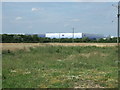
River Island distribution centre
This is a seriously big depot, just like the giant John Lewis distribution centre next door.
Image: © Mr Ignavy
Taken: 28 Oct 2011
0.25 miles