IMAGES TAKEN NEAR TO
Hurst End, NEWPORT PAGNELL, MK16 9HS
Introduction
This page details the photographs taken nearby to Hurst End, MK16 9HS by members of the Geograph project.
The Geograph project started in 2005 with the aim of publishing, organising and preserving representative images for every square kilometre of Great Britain, Ireland and the Isle of Man.

There are currently over 7.5m images from over14,400 individuals and you can help contribute to the project by visiting https://www.geograph.org.uk
Image Map
Images are licensed for reuse under creativecommons.org/licenses/by-sa/2.0
Notes
- Clicking on the map will re-center to the selected point.
- The higher the marker number, the further away the image location is from the centre of the postcode.
Image Listing (5 Images Found)
Images are licensed for reuse under creativecommons.org/licenses/by-sa/2.0
Image
Details
Distance
1
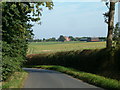
Hurstend Farm
Hurstend Farm is now being used as a rural industrial estate.
Image: © Richard Schmidt
Taken: 9 Sep 2006
0.04 miles
2
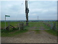
Public Footpath
Its signposted as a public footpath, however my O/S Explorer map says this is a bridleway through North Crawley, Brook End
Image: © Mr Biz
Taken: 2 Apr 2011
0.10 miles
3
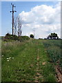
Powerlines by the bridleway to Hurst End
Image: © Philip Jeffrey
Taken: 26 Jun 2013
0.22 miles
4
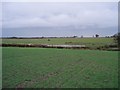
Small pond in field
Artificial pond put in by landowner - not marked on maps yet
Image: © Mike Wilkinson
Taken: 25 Nov 2006
0.22 miles