
IMAGES TAKEN NEAR TO
Chapman Avenue, MILTON KEYNES, MK14 7PF
Introduction
This page details the photographs taken nearby to Chapman Avenue, MK14 7PF by members of the Geograph project.
The Geograph project started in 2005 with the aim of publishing, organising and preserving representative images for every square kilometre of Great Britain, Ireland and the Isle of Man.

There are currently over 7.5m images from over14,400 individuals and you can help contribute to the project by visiting https://www.geograph.org.uk
Image Map
Images are licensed for reuse under creativecommons.org/licenses/by-sa/2.0
Notes
- Clicking on the map will re-center to the selected point.
- The higher the marker number, the further away the image location is from the centre of the postcode.
Image Listing (4 Images Found)
Images are licensed for reuse under creativecommons.org/licenses/by-sa/2.0
Image
Details
Distance
1
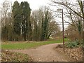
Paths, Downs Barn
The path has just emerged from under a bridge carrying Capel Drive and now runs (right) parallel to Dansteed Way. The turn to the left runs past Woodlands Day Nursery to Byerly Place.
Image: © Derek Harper
Taken: 4 Feb 2011
0.13 miles
2

Great Linford : Neath Hill Roundabout
Neath Hill Roundabout in the Great Linford area of Milton Keynes, with a silver Vauxhall Astra (registration DY65 HZE) leading a red BMW 3 Series (RA65 OJZ) around the curve. The roundabout is set within mature tree cover typical of the city’s landscaped grid road system, with tall street lighting columns positioned along the verge. Summer greenery is abundant, with a mix of native deciduous species including ash and sycamore, and roadside grass verges beginning to show dry patches from warm weather. A directional sign is partially visible on the right, reflecting Milton Keynes’ distinctive road signage layout.
Image: © Lewis Clarke
Taken: 26 Jun 2024
0.17 miles
3
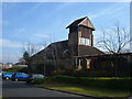
Cross and Stable Church & Community Centre
The church located on the Downs Barn estate in Milton Keynes.
Image: © Mr Biz
Taken: 31 Jan 2009
0.18 miles
4

Great Linford : V9 Overstreet
A white Ford Transit panel van crosses V9 Overstreet in the Great Linford area of Milton Keynes, near the junction with Tower Drive. To the left, a black-on-white directional sign points towards 'Neath Hill Local Centre', indicating the nearby community facilities.
Image: © Lewis Clarke
Taken: 26 Jun 2024
0.24 miles