IMAGES TAKEN NEAR TO
Mullen Avenue, MILTON KEYNES, MK14 7LG
Introduction
This page details the photographs taken nearby to Mullen Avenue, MK14 7LG by members of the Geograph project.
The Geograph project started in 2005 with the aim of publishing, organising and preserving representative images for every square kilometre of Great Britain, Ireland and the Isle of Man.

There are currently over 7.5m images from over14,400 individuals and you can help contribute to the project by visiting https://www.geograph.org.uk
Image Map
Images are licensed for reuse under creativecommons.org/licenses/by-sa/2.0
Notes
- Clicking on the map will re-center to the selected point.
- The higher the marker number, the further away the image location is from the centre of the postcode.
Image Listing (22 Images Found)
Images are licensed for reuse under creativecommons.org/licenses/by-sa/2.0
Image
Details
Distance
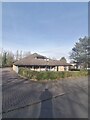
3
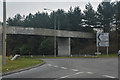
Downs Barn Boulevard
A tree lined boulevard typical of many of the estates around central Milton Keynes.
Image: © Richard Schmidt
Taken: 2 Sep 2006
0.08 miles
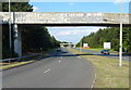
4
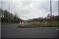
Milton Keynes : Portway A509
Looking along Portway from Belvedere Roundabout.
Image: © Lewis Clarke
Taken: 24 Mar 2018
0.09 miles
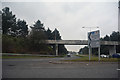
5
Milton Keynes : Portway A509
A road heading off from Belvedere Roundabout.
Image: © Lewis Clarke
Taken: 24 Mar 2018
0.09 miles
6
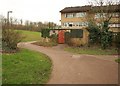
Path, Conniburrow
The path, emerging from beneath Marlborough Street near the Belvedere Roundabout, twists path the rear of houses on Yarrow Place.
Image: © Derek Harper
Taken: 4 Feb 2011
0.11 miles
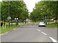
7
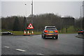
Milton Keynes : Belvedere Roundabout
A roundabout on Portway with Marlborough Street on the left.
Image: © Lewis Clarke
Taken: 24 Mar 2018
0.11 miles
8
Milton Keynes : Marlborough Street B4034
Looking along Marlborough Street from Belvedere Roundabout.
Image: © Lewis Clarke
Taken: 24 Mar 2018
0.14 miles
9
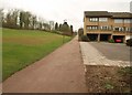
Path, Conniburrow
A long path (continuing the one shown in Image), running in a straight line parallel to the Portway, which is at the top of the slope on the left, and climbing steadily towards Bradwell Common.
Image: © Derek Harper
Taken: 4 Feb 2011
0.14 miles
10
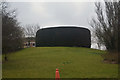
Milton Keynes : Hedgerow
Some landscaping with a hedgerow on the brow of a hill off of Portway.
Image: © Lewis Clarke
Taken: 24 Mar 2018
0.16 miles