IMAGES TAKEN NEAR TO
Blackhill Drive, MILTON KEYNES, MK12 5TS
Introduction
This page details the photographs taken nearby to Blackhill Drive, MK12 5TS by members of the Geograph project.
The Geograph project started in 2005 with the aim of publishing, organising and preserving representative images for every square kilometre of Great Britain, Ireland and the Isle of Man.

There are currently over 7.5m images from over14,400 individuals and you can help contribute to the project by visiting https://www.geograph.org.uk
Image Map
Images are licensed for reuse under creativecommons.org/licenses/by-sa/2.0
Notes
- Clicking on the map will re-center to the selected point.
- The higher the marker number, the further away the image location is from the centre of the postcode.
Image Listing (10 Images Found)
Images are licensed for reuse under creativecommons.org/licenses/by-sa/2.0
Image
Details
Distance
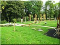
1
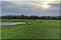
Sheep by the Wolverton Mill balancing lakes
Image: © Philip Jeffrey
Taken: 14 Mar 2018
0.12 miles
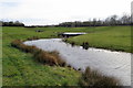
3
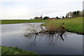
Water management lake at Wolverton Mill
Image: © Philip Jeffrey
Taken: 14 Mar 2018
0.15 miles
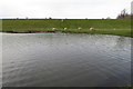
5
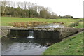
Weir and stepping stones on the balancing lake
Image: © Philip Jeffrey
Taken: 14 Mar 2018
0.17 miles
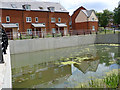
6
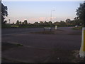
Harnett Drive at the junction of Stratford Road
Image: © David Howard
Taken: 8 Aug 2012
0.19 miles
7
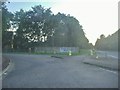
Harnett Drive at the junction of Stratford Road
Image: © David Howard
Taken: 8 Aug 2012
0.19 miles
10
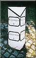
Old Milepost by Stratford Road, Wolverton
Cast iron post by the UC road, in parish of Wolverton (Milton Keynes District), Stratford Road; Wolverton Mill, by Wolverton Park, opposite Mill End, 100m West of double mini-roundabout, on grass bank set in granite setts, on South side of road. Newport twin plaque, erected by the Buckingham & Newport Pagnell turnpike trust in the 19th century.
Inscription reads:-
: BUCKINGHAM / 9 / STRATFORD / 1 : : NEWPORT / 5 / STRATFORD / 1 :
Grade II listed.
List Entry Number: 1389364 https://historicengland.org.uk/listing/the-list/list-entry/1389364
Milestone Society National ID: BU_BUNP09
Image: © A Rosevear & J Higgins
Taken: 2 Aug 2003
0.24 miles