IMAGES TAKEN NEAR TO
Holdom Avenue, MILTON KEYNES, MK1 1QU
Introduction
This page details the photographs taken nearby to Holdom Avenue, MK1 1QU by members of the Geograph project.
The Geograph project started in 2005 with the aim of publishing, organising and preserving representative images for every square kilometre of Great Britain, Ireland and the Isle of Man.

There are currently over 7.5m images from over14,400 individuals and you can help contribute to the project by visiting https://www.geograph.org.uk
Image Map
Images are licensed for reuse under creativecommons.org/licenses/by-sa/2.0
Notes
- Clicking on the map will re-center to the selected point.
- The higher the marker number, the further away the image location is from the centre of the postcode.
Image Listing (24 Images Found)
Images are licensed for reuse under creativecommons.org/licenses/by-sa/2.0
Image
Details
Distance
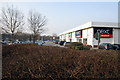
1
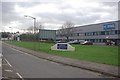
Saxon Park Industrial Estate
Looking along Bond Avenue in one of Milton Keynes' industrial zones.
Image: © Stephen McKay
Taken: 7 Jan 2012
0.07 miles
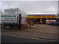
4
National Tyres on the corner of Bond Avenue
Image: © David Howard
Taken: 4 Apr 2012
0.11 miles
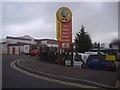
5
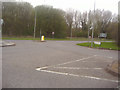
Roundabout on Bletcham Way and Bond Avenue, Bletchley
This is the southern end of what is now part of Milton Keynes New Town
Image: © David Howard
Taken: 4 Apr 2012
0.12 miles
6
Industrial estate from Denbigh Roundabout
Image: © John Firth
Taken: 22 Sep 2013
0.15 miles
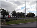
9
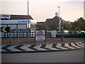
Tesco and a Roundabout
Title covers exactly what your seeing!!
Image: © Mr Biz
Taken: 24 Jul 2006
0.17 miles
10
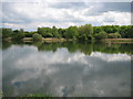
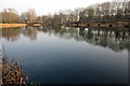
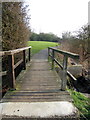
Milton Keynes: Mount Farm Park Lake
The lake is probably an old gravel pit working, and is certainly shown on the Ordnance Survey 6" to the mile maps of the area from 1952, thus pre-dating all the main development of Milton Keynes. It straddles this grid square and Image to the north. For another view, in that grid square, please see Image
Image: © Nigel Cox
Taken: 1 May 2010
0.18 miles