IMAGES TAKEN NEAR TO
Newport Road, MILTON KEYNES, MK10 7ED
Introduction
This page details the photographs taken nearby to Newport Road, MK10 7ED by members of the Geograph project.
The Geograph project started in 2005 with the aim of publishing, organising and preserving representative images for every square kilometre of Great Britain, Ireland and the Isle of Man.

There are currently over 7.5m images from over14,400 individuals and you can help contribute to the project by visiting https://www.geograph.org.uk
Image Map
Images are licensed for reuse under creativecommons.org/licenses/by-sa/2.0
Notes
- Clicking on the map will re-center to the selected point.
- The higher the marker number, the further away the image location is from the centre of the postcode.
Image Listing (16 Images Found)
Images are licensed for reuse under creativecommons.org/licenses/by-sa/2.0
Image
Details
Distance
2
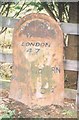
Old Milepost by the A5130 in Broughton, Milton Keynes
Pressed steel post by the former A5130, in parish of Broughton (Milton Keynes District), Newport Road. Outside Broughton Manor, opposite Broughton Grounds Lane, on grass verge back to a wooden fence and trees, on South side of road. Bucks pressing, erected by the County Council in the 20th century.
Area has been redeveloped so the milepost now stands behind a cycle track.
Inscription reads:-
: NEWPORT / PAGNELL / 3 : : BROUGHTON / PARISH / LONDON / 47 : : WOBURN / 5½ :
Milestone Society National ID: BU_NPWO03
Image: © A Rosevear
Taken: 17 Jan 2004
0.10 miles
3
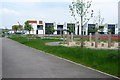
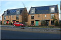
New housing on Newport Road (A5130), Broughton
Image: © JThomas
Taken: 22 Aug 2015
0.13 miles
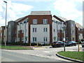
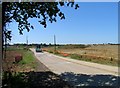
4
Newport Road (A5130), Broughton
Looking south east.
Image: © JThomas
Taken: 22 Aug 2015
0.15 miles
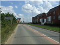
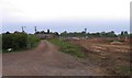
6
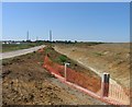
Road and culvert
A chunk of land between the M1 and the Broughton area of Milton Keynes which is perhaps for commercial property development. Very little building activity visible in June 2009 but perhaps they are still busy getting the infrastructure in place. Perhaps a return visit in 2010 to see what has happened in a year?
Image: © Andrew Tatlow
Taken: 1 Jun 2009
0.16 miles
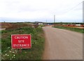
7
Broughton Grounds Lane
A view of the site being cleared near to the Broughton area of Milton Keynes.
Image: © Andrew Tatlow
Taken: 1 Jun 2009
0.17 miles
8
Former country lane in a building site
The only activity on this building site near to the Broughton area of Milton Keynes was from some earth moving equipment.
Image: © Andrew Tatlow
Taken: 4 May 2009
0.17 miles
9
At the rear of Brooklands Farm Broughton
To the left is Brooklands Farm which is the home to several commercial organisations. Within the Brooklands Farm site you can have Colonic Irrigation, Colonic Hydrotherapy or Nutritional Testing or you could attend the Mountain Chefs Cookery School and in between there are opportunities for cosmetic dentistry!
To the right of the track is a building site; most of the Broughton area of Milton Keynes was a building site when this picture was taken!
Image: © Andrew Tatlow
Taken: 4 May 2009
0.18 miles
10
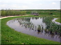
Path through the newly constructed Brooklands Meadow Park
Image: © Philip Jeffrey
Taken: 18 May 2012
0.20 miles