
IMAGES TAKEN NEAR TO
Nuthatch Place, GILLINGHAM, ME8 7BH
Introduction
This page details the photographs taken nearby to Nuthatch Place, ME8 7BH by members of the Geograph project.
The Geograph project started in 2005 with the aim of publishing, organising and preserving representative images for every square kilometre of Great Britain, Ireland and the Isle of Man.

There are currently over 7.5m images from over14,400 individuals and you can help contribute to the project by visiting https://www.geograph.org.uk
Image Map
Images are licensed for reuse under creativecommons.org/licenses/by-sa/2.0
Notes
- Clicking on the map will re-center to the selected point.
- The higher the marker number, the further away the image location is from the centre of the postcode.
Image Listing (51 Images Found)
Images are licensed for reuse under creativecommons.org/licenses/by-sa/2.0
Image
Details
Distance

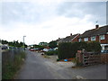
3
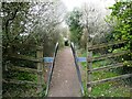
Berengrave Local Nature Reserve, Rainham
The Lower Rainham Road entrance. The wooded reserve is an old chalk pit which provided chalk for cement production between 1901 and 1931.
Image: © pam fray
Taken: 5 Apr 2022
0.07 miles
4
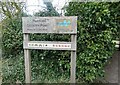
Entrance to Riverside Country Park, Medway
The path leads through the northern end of Berengrave Local Nature Reserve to the River Medway estuary.
Image: © pam fray
Taken: 5 Apr 2022
0.07 miles

6
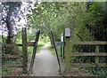
Entrance to Berengrave Local Nature Reserve, Rainham
This is the northern part of the reserve known as Rainham Dock East. The reserve is bisected by Lower Rainham Road. It is an area of approximately 15 hectares which is located between the River Medway and the northern edge of the residential area of Rainham, Kent. It forms part of the larger Riverside Country Park. The northern part of the reserve is the site of the old British Standard Cement Company’s works which was operational from 1912 until the Second World War.
Image: © pam fray
Taken: 27 Sep 2016
0.07 miles
7
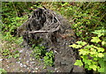
Berengrave Local Nature Reserve, Rainham
Roots of a fallen tree by a footpath. The reserve is an area of approximately 15 hectares which is located between the River Medway and the northern edge of the residential area of Rainham, Kent. It forms part of the larger Riverside Country Park. The northern part of the reserve is the site of the old British Standard Cement Company’s works which was operational from 1912 until the Second World War, whilst the southern part is the site of the old Rainham chalk quarry which supplied chalk to the cement works.
Image: © pam fray
Taken: 27 Sep 2016
0.07 miles
8

Narrow bridge: Lower Rainham
The bridge crosses the tramway used from around 1900 to 1931 to take chalk from the quarry to the wharf. Initially chalk was shipped to cement plants surrounding the Medway estuary - most probably the one at Queenborough. After 1923, chalk was delivered to the British Standard cement plant at the wharf. For details, see http://www.cementkilns.co.uk/cement_kiln_british_standard.html and related pages. Although the tramway ceased to operate in 1931, the bridge has constricted the road to a single lane ever since.
Image: © Dylan Moore
Taken: 1 Apr 2014
0.08 miles
9
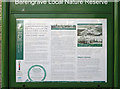
Information board at Berengrave Nature Reserve
The part of the nature reserve north of the road is the site of the British Standard cement plant which operated from 1913 to 1931. For details, see http://www.cementkilns.co.uk/cement_kiln_british_standard.html and related pages.
Image: © Dylan Moore
Taken: 1 Apr 2014
0.08 miles
10
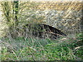
Disused tunnel under Lower Rainham Road
This tunnel was used to transport chalk to the cement works at Motney Hill
Image: © Phil Bull
Taken: 31 Mar 2009
0.09 miles