IMAGES TAKEN NEAR TO
Regency Close, GILLINGHAM, ME8 0LA
Introduction
This page details the photographs taken nearby to Regency Close, ME8 0LA by members of the Geograph project.
The Geograph project started in 2005 with the aim of publishing, organising and preserving representative images for every square kilometre of Great Britain, Ireland and the Isle of Man.

There are currently over 7.5m images from over14,400 individuals and you can help contribute to the project by visiting https://www.geograph.org.uk
Image Map (Loading...)


Getting Data...Please wait
Leaflet Map data © OpenStreetMap
Images are licensed for reuse under creativecommons.org/licenses/by-sa/2.0
Notes
- Clicking on the map will re-center to the selected point.
- The higher the marker number, the further away the image location is from the centre of the postcode.
Image Listing (27 Images Found)
Images are licensed for reuse under creativecommons.org/licenses/by-sa/2.0
Image
Details
Distance
2

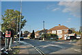
Pussy willow catkins
Maidstone Road, Wigmore
Image: © Penny Mayes
Taken: 15 Mar 2006
0.05 miles
6
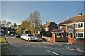
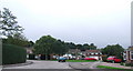
Maidstone Road meets Wigmore Road, Wigmore
Image: © Chris Whippet
Taken: 22 Oct 2011
0.07 miles
10
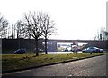
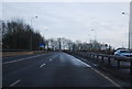
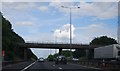
Viaduct, Parkwood
Looking SW towards the corner of the square, the TQ8063 grid lines cross under the bridge which carries the A278 Hoath Way, M2 approach road to junction 4.
Image: © Penny Mayes
Taken: 15 Mar 2006
0.10 miles