IMAGES TAKEN NEAR TO
Cheriton Road, GILLINGHAM, ME8 0ES
Introduction
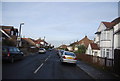
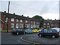
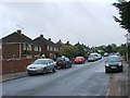
This page details the photographs taken nearby to Cheriton Road, ME8 0ES by members of the Geograph project.
The Geograph project started in 2005 with the aim of publishing, organising and preserving representative images for every square kilometre of Great Britain, Ireland and the Isle of Man.

There are currently over 7.5m images from over14,400 individuals and you can help contribute to the project by visiting https://www.geograph.org.uk
Image Map (Loading...)


Getting Data...Please wait
Leaflet Map data © OpenStreetMap
Images are licensed for reuse under creativecommons.org/licenses/by-sa/2.0
Notes
- Clicking on the map will re-center to the selected point.
- The higher the marker number, the further away the image location is from the centre of the postcode.
Image Listing (43 Images Found)
Images are licensed for reuse under creativecommons.org/licenses/by-sa/2.0
Image
Details
Distance

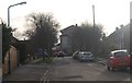
4
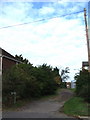
Kendal Way, Rainham
Kendal Way was originally lined with a few prefabs before the construction of nearby flats in the 1960s, relegating it to an unmade service road.
Image: © Chris Whippet
Taken: 9 Sep 2010
0.05 miles