IMAGES TAKEN NEAR TO
Clermont Close, GILLINGHAM, ME7 3TQ
Introduction
This page details the photographs taken nearby to Clermont Close, ME7 3TQ by members of the Geograph project.
The Geograph project started in 2005 with the aim of publishing, organising and preserving representative images for every square kilometre of Great Britain, Ireland and the Isle of Man.

There are currently over 7.5m images from over14,400 individuals and you can help contribute to the project by visiting https://www.geograph.org.uk
Image Map
Images are licensed for reuse under creativecommons.org/licenses/by-sa/2.0
Notes
- Clicking on the map will re-center to the selected point.
- The higher the marker number, the further away the image location is from the centre of the postcode.
Image Listing (127 Images Found)
Images are licensed for reuse under creativecommons.org/licenses/by-sa/2.0
Image
Details
Distance
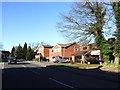
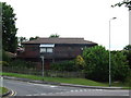
2
Chapel Lane, Hempstead
Chapel Lane originally ran from the Bell Inn in Bredhurst to Hempstead Village. It was originally bisected by the construction of the M2 motorway in the early 1960s and then again by the construction of Hempstead Valley Drive in the late 1970s. This northern section connects Hempstead Valley Drive and Hempstead Road and contains suburban housing built in the early 1980s.
Image: © Chris Whippet
Taken: 11 May 2016
0.03 miles
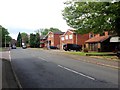
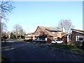
3
Chapel Lane, Hempstead
This is the only section of Chapel Lane still open to traffic, it was widened and had houses built along it in the early 1980s.
Image: © Chris Whippet
Taken: 16 Mar 2014
0.03 miles
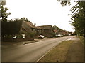
7
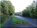
Hempstead Valley Drive
Whitegate Wood on the left adjoins the west side of Hempstead Valley Drive. This is the southern end of the wood. On this side of the footbridge ahead, the path follows through the wood for a while or takes a short cut to Magdalen Close - see also www.geograph.org.uk/photo/7911767
Image: © Marathon
Taken: 29 Oct 2024
0.06 miles
10

Hempstead Valley shopping centre
Inside looking east from outside M&S. This walk has the highest roof.
Image: © Penny Mayes
Taken: 3 Jan 2006
0.07 miles