IMAGES TAKEN NEAR TO
Hazlemere Drive, GILLINGHAM, ME7 2TD
Introduction
This page details the photographs taken nearby to Hazlemere Drive, ME7 2TD by members of the Geograph project.
The Geograph project started in 2005 with the aim of publishing, organising and preserving representative images for every square kilometre of Great Britain, Ireland and the Isle of Man.

There are currently over 7.5m images from over14,400 individuals and you can help contribute to the project by visiting https://www.geograph.org.uk
Image Map
Images are licensed for reuse under creativecommons.org/licenses/by-sa/2.0
Notes
- Clicking on the map will re-center to the selected point.
- The higher the marker number, the further away the image location is from the centre of the postcode.
Image Listing (55 Images Found)
Images are licensed for reuse under creativecommons.org/licenses/by-sa/2.0
Image
Details
Distance
3
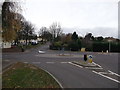
Roundabout on Grange Road
Grange Road leads from Grange and the A289 Yokosuka Way towards Gillingham.
Lower Woodlands Road leads right towards the A289 Pier Road.
Woodlands Road leads left towards the A2 London Road.
Image: © David Anstiss
Taken: 4 Dec 2011
0.08 miles
4
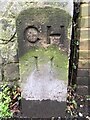
Old Boundary Marker on Grange Road, Gillingham
Municipal Boundary Marker on the south side of Grange Road, Gillingham, on the outside of the northwest corner of No. 346. Inscribed CH / 14 (part of the 4 has cut away, making it look like a 1). On the boundary of Chatham municipal borough, which included part of Gillingham parish until 1903. To the east was Grange parish from 1866 to 1906, in Gillingham urban district.
Milestone Society National ID: KE_GILGRA14pb
Image: © A France
Taken: 15 Jan 2021
0.08 miles
7
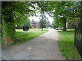
Grace Manor, Gillingham
Seen here from Grange Road, Grace Manor is now a nursing home.
Image: © Marathon
Taken: 29 May 2016
0.11 miles
8
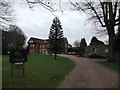
Grace Manor, Gillingham
This large Grade II listed manor house used to be called Grench Manor.
See http://www.britishlistedbuildings.co.uk/en-462564-grench-manor-gillingham for more details about the manor house.
On the right, is the ruins of a former chapel.
See http://www.britishlistedbuildings.co.uk/en-462565-remains-of-chapel-in-north-east-corner-o for more details of the ruins.
Image: © David Anstiss
Taken: 4 Dec 2011
0.11 miles
9
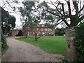
Grace Manor, Gillingham
This large Grade II listed manor house used to be called Grench Manor.
See http://www.britishlistedbuildings.co.uk/en-462564-grench-manor-gillingham for more details about the manor house.
Image: © David Anstiss
Taken: 4 Dec 2011
0.11 miles