IMAGES TAKEN NEAR TO
Parr Avenue, GILLINGHAM, ME7 1UL
Introduction
This page details the photographs taken nearby to Parr Avenue, ME7 1UL by members of the Geograph project.
The Geograph project started in 2005 with the aim of publishing, organising and preserving representative images for every square kilometre of Great Britain, Ireland and the Isle of Man.

There are currently over 7.5m images from over14,400 individuals and you can help contribute to the project by visiting https://www.geograph.org.uk
Image Map
Images are licensed for reuse under creativecommons.org/licenses/by-sa/2.0
Notes
- Clicking on the map will re-center to the selected point.
- The higher the marker number, the further away the image location is from the centre of the postcode.
Image Listing (155 Images Found)
Images are licensed for reuse under creativecommons.org/licenses/by-sa/2.0
Image
Details
Distance
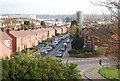
1
Church Path (the western end)
The view eastwards.
Image: © Michael Flegg
Taken: 27 Nov 2008
0.00 miles
5
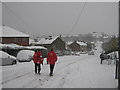
Postmen on Parr Road
Due to the recent heavy snows, postal delieveries have been severely affected.
Some local post can be delivered.
These minor roads have not been salted and are very dangeous to drive on.
Image: © David Anstiss
Taken: 3 Dec 2010
0.02 miles
10
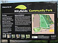
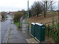
Hillyfield Community Park Information Board
This park board is on Parr Avenue. Near an entrance to the park.
Image: © David Anstiss
Taken: 21 Apr 2009
0.04 miles