IMAGES TAKEN NEAR TO
Purser Way, GILLINGHAM, ME7 1NE
Introduction
This page details the photographs taken nearby to Purser Way, ME7 1NE by members of the Geograph project.
The Geograph project started in 2005 with the aim of publishing, organising and preserving representative images for every square kilometre of Great Britain, Ireland and the Isle of Man.

There are currently over 7.5m images from over14,400 individuals and you can help contribute to the project by visiting https://www.geograph.org.uk
Image Map
Images are licensed for reuse under creativecommons.org/licenses/by-sa/2.0
Notes
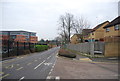
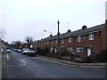
- Clicking on the map will re-center to the selected point.
- The higher the marker number, the further away the image location is from the centre of the postcode.
Image Listing (158 Images Found)
Images are licensed for reuse under creativecommons.org/licenses/by-sa/2.0
Image
Details
Distance
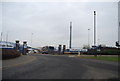
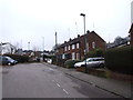
3
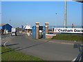
Entrance to Chatham Docks
This is just off the A289 at Gillingham Gate.
Image: © Danny P Robinson
Taken: 14 Oct 2007
0.04 miles
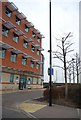
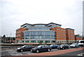
7
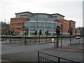
Medway Police Station
A newly opened building, replacing several smaller police stations distributed around the area.
Image: © Danny P Robinson
Taken: 1 Jan 2008
0.05 miles
9
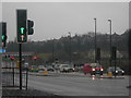
Gillingham Gate
This is very near the entrance to the docks.
Image: © Danny P Robinson
Taken: 24 Mar 2006
0.05 miles