IMAGES TAKEN NEAR TO
Kelly Drive, GILLINGHAM, ME7 1FF
Introduction
This page details the photographs taken nearby to Kelly Drive, ME7 1FF by members of the Geograph project.
The Geograph project started in 2005 with the aim of publishing, organising and preserving representative images for every square kilometre of Great Britain, Ireland and the Isle of Man.

There are currently over 7.5m images from over14,400 individuals and you can help contribute to the project by visiting https://www.geograph.org.uk
Image Map
Images are licensed for reuse under creativecommons.org/licenses/by-sa/2.0
Notes
- Clicking on the map will re-center to the selected point.
- The higher the marker number, the further away the image location is from the centre of the postcode.
Image Listing (196 Images Found)
Images are licensed for reuse under creativecommons.org/licenses/by-sa/2.0
Image
Details
Distance
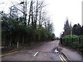
1
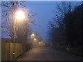
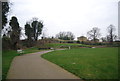
Cumberland Road
This road is actually a footpath in the Lower Lines Park leading from Johnston Road to Medway Avenue.
Image: © David Anstiss
Taken: 15 Mar 2011
0.02 miles
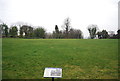
5
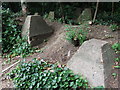
Anti Tank Blocks, near Brompton Barracks
Image: © Chris Whippet
Taken: 5 Jul 2010
0.06 miles
8
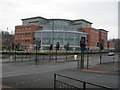
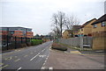
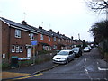
Medway Police Station
A newly opened building, replacing several smaller police stations distributed around the area.
Image: © Danny P Robinson
Taken: 1 Jan 2008
0.06 miles