IMAGES TAKEN NEAR TO
West Street, GILLINGHAM, ME7 1EF
Introduction
This page details the photographs taken nearby to West Street, ME7 1EF by members of the Geograph project.
The Geograph project started in 2005 with the aim of publishing, organising and preserving representative images for every square kilometre of Great Britain, Ireland and the Isle of Man.

There are currently over 7.5m images from over14,400 individuals and you can help contribute to the project by visiting https://www.geograph.org.uk
Image Map
Images are licensed for reuse under creativecommons.org/licenses/by-sa/2.0
Notes
- Clicking on the map will re-center to the selected point.
- The higher the marker number, the further away the image location is from the centre of the postcode.
Image Listing (301 Images Found)
Images are licensed for reuse under creativecommons.org/licenses/by-sa/2.0
Image
Details
Distance
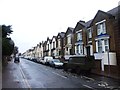
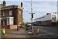
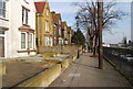
4
Kingswood Road, Gillingham
This is looking across Railway Street next to Gillingham station.
Image: © Marathon
Taken: 29 May 2016
0.04 miles
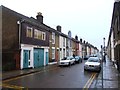
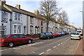
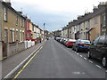
6
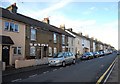
Street parking, Victoria St
Most of the houses in this area lack off street parking.
Image: © N Chadwick
Taken: 30 Oct 2010
0.05 miles
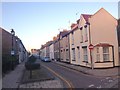
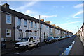
8
Victoria Street, Gillingham
This road leads towards central Gillingham from Crown and Saunders Streets.
Image: © David Anstiss
Taken: 8 Jul 2009
0.05 miles