IMAGES TAKEN NEAR TO
Alex Hughes Close, SNODLAND, ME6 5ST
Introduction
This page details the photographs taken nearby to Alex Hughes Close, ME6 5ST by members of the Geograph project.
The Geograph project started in 2005 with the aim of publishing, organising and preserving representative images for every square kilometre of Great Britain, Ireland and the Isle of Man.

There are currently over 7.5m images from over14,400 individuals and you can help contribute to the project by visiting https://www.geograph.org.uk
Image Map
Images are licensed for reuse under creativecommons.org/licenses/by-sa/2.0
Notes
- Clicking on the map will re-center to the selected point.
- The higher the marker number, the further away the image location is from the centre of the postcode.
Image Listing (65 Images Found)
Images are licensed for reuse under creativecommons.org/licenses/by-sa/2.0
Image
Details
Distance
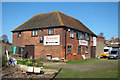
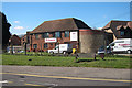
2
The Oast House, Hollow Lane, Harn Hill, Snodland, Kent
Image: © Oast House Archive
Taken: 26 Apr 2008
0.04 miles
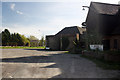
3
The Oast House, Hollow Lane, Snodland, Kent
Image: © Oast House Archive
Taken: 23 Mar 2011
0.05 miles
4
The Oast House, Hollow Lane, Snodland, Kent
Image: © Oast House Archive
Taken: 23 Mar 2011
0.05 miles
5
The Oast House, Hollow Lane, Snodland, Kent
Image: © Oast House Archive
Taken: 23 Mar 2011
0.05 miles

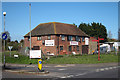
8

Ham Hill Filling Station
This picture was taken during the fuel crisis of September 2000, when lorry drivers blocked key petrol supplies in protest about high petrol prices.
Image: © Hywel Williams
Taken: 18 Sep 2000
0.08 miles