IMAGES TAKEN NEAR TO
Vale Drive, CHATHAM, ME5 9XB
Introduction
This page details the photographs taken nearby to Vale Drive, ME5 9XB by members of the Geograph project.
The Geograph project started in 2005 with the aim of publishing, organising and preserving representative images for every square kilometre of Great Britain, Ireland and the Isle of Man.

There are currently over 7.5m images from over14,400 individuals and you can help contribute to the project by visiting https://www.geograph.org.uk
Image Map
Images are licensed for reuse under creativecommons.org/licenses/by-sa/2.0
Notes
- Clicking on the map will re-center to the selected point.
- The higher the marker number, the further away the image location is from the centre of the postcode.
Image Listing (54 Images Found)
Images are licensed for reuse under creativecommons.org/licenses/by-sa/2.0
Image
Details
Distance
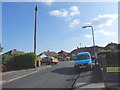
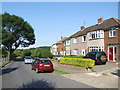
1
Barberry Avenue, Davis Estate, Chatham
Image: © Chris Whippet
Taken: 22 Jul 2014
0.04 miles
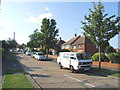
4
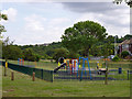
Play area, Concord Avenue
Viewed from the footpath up to Maidstone Road.
Image: © Robin Webster
Taken: 25 Jun 2012
0.11 miles
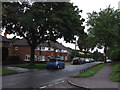
6
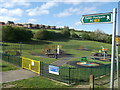
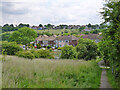
Play area, Concord Avenue
Viewed from the footpath up to Maidstone Road.
On the ridge is Horsted Park (a new housing development being built on the site of a former college).
Image: © David Anstiss
Taken: 8 May 2013
0.11 miles
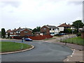
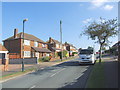
9
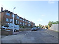
Amethyst Avenue, Davis Estate, Chatham
Image: © Chris Whippet
Taken: 22 Jul 2014
0.13 miles