IMAGES TAKEN NEAR TO
Malus Close, CHATHAM, ME5 9SU
Introduction
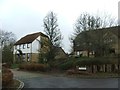
This page details the photographs taken nearby to Malus Close, ME5 9SU by members of the Geograph project.
The Geograph project started in 2005 with the aim of publishing, organising and preserving representative images for every square kilometre of Great Britain, Ireland and the Isle of Man.

There are currently over 7.5m images from over14,400 individuals and you can help contribute to the project by visiting https://www.geograph.org.uk
Image Map
Images are licensed for reuse under creativecommons.org/licenses/by-sa/2.0
Notes
- Clicking on the map will re-center to the selected point.
- The higher the marker number, the further away the image location is from the centre of the postcode.
Image Listing (33 Images Found)
Images are licensed for reuse under creativecommons.org/licenses/by-sa/2.0
Image
Details
Distance
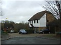
10
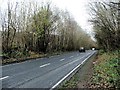
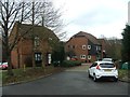
Beechen Bank Road, Walderslade
Beechen Bank Road was constructed in the late 1970s to by-pass the nearby narrow Boxley Road as this area became more developed with housing.
Image: © Chris Whippet
Taken: 17 Dec 2014
0.10 miles