IMAGES TAKEN NEAR TO
Sadlers Close, CHATHAM, ME5 9RR
Introduction
This page details the photographs taken nearby to Sadlers Close, ME5 9RR by members of the Geograph project.
The Geograph project started in 2005 with the aim of publishing, organising and preserving representative images for every square kilometre of Great Britain, Ireland and the Isle of Man.

There are currently over 7.5m images from over14,400 individuals and you can help contribute to the project by visiting https://www.geograph.org.uk
Image Map
Images are licensed for reuse under creativecommons.org/licenses/by-sa/2.0
Notes
- Clicking on the map will re-center to the selected point.
- The higher the marker number, the further away the image location is from the centre of the postcode.
Image Listing (30 Images Found)
Images are licensed for reuse under creativecommons.org/licenses/by-sa/2.0
Image
Details
Distance
3
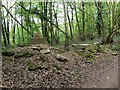
Remains of a derelict cottage, Walderslade Woods
Before the development of Walderslade Woods in the late 1970s and early 1980s this area around Hallsfield Road and Victoria Road contained a few bungalows and cottages. All that remains of this one is a few bricks and the fireplace.
Image: © Chris Whippet
Taken: 21 Apr 2017
0.07 miles
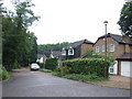
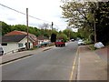
4
Entrance to Hallsfield Road, Chatham
From Walderslade Woods Road.
Image: © Chris Whippet
Taken: 18 Jun 2009
0.08 miles
7
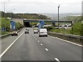
M2, Junction 3 (Blue Bell Wood)
The sliproad from the A229 to the northbound M2 at Junction 3.
Image: © David Dixon
Taken: 15 May 2013
0.12 miles
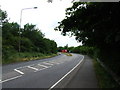
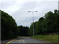
8
Maidstone Road, Bridgewood
Formerly part of the A229 Chatham-Maidstone Road, this section was by-passed following the widening of the M2 and alterations to nearby Junction 3.
Image: © Chris Whippet
Taken: 27 Aug 2010
0.13 miles
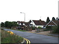
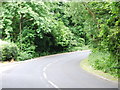
9
Former A229, Blue Bell Hill
This short stretch of road used to be part of the A229 Maidstone Road.
Image: © Chris Whippet
Taken: 12 Jun 2009
0.14 miles
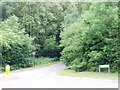
10
Taddington Wood Lane, Walderslade Woods
Image: © Chris Whippet
Taken: 18 Jun 2009
0.14 miles