IMAGES TAKEN NEAR TO
Robin Hood Lane, CHATHAM, ME5 9QU
Introduction
This page details the photographs taken nearby to Robin Hood Lane, ME5 9QU by members of the Geograph project.
The Geograph project started in 2005 with the aim of publishing, organising and preserving representative images for every square kilometre of Great Britain, Ireland and the Isle of Man.

There are currently over 7.5m images from over14,400 individuals and you can help contribute to the project by visiting https://www.geograph.org.uk
Image Map
Images are licensed for reuse under creativecommons.org/licenses/by-sa/2.0
Notes
- Clicking on the map will re-center to the selected point.
- The higher the marker number, the further away the image location is from the centre of the postcode.
Image Listing (39 Images Found)
Images are licensed for reuse under creativecommons.org/licenses/by-sa/2.0
Image
Details
Distance
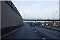
2
Bridge over the M2, Blue Bell Hill
On Robin Hood Lane Upper.
Image: © Chris Whippet
Taken: 12 Jun 2009
0.05 miles
7
St. Alban: the parish church of Blue Bell Hill
Image: © Robert Edwards
Taken: 10 Jun 2009
0.12 miles
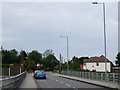
8
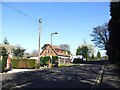
Robin Hood Lane Upper, Blue Bell Hill
Image: © Chris Whippet
Taken: 15 Apr 2014
0.13 miles
9
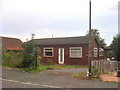
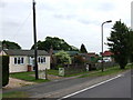
Bungalow on Robin Hood Lane, Blue Bell Hill
Image: © Chris Whippet
Taken: 19 Sep 2010
0.13 miles
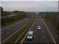
10
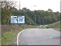
Approaching Walderslade Woods from M2
This junction was completed in 2003. Junction 3 of the M2 was significantly realigned and older maps will not show it correctly. The photographer is facing away from the M2 junction just behind him. There is a traffic light junction ahead, concealed by the terrain.
Image: © Danny P Robinson
Taken: 9 Oct 2005
0.14 miles