IMAGES TAKEN NEAR TO
Walsham Road, CHATHAM, ME5 9HX
Introduction
This page details the photographs taken nearby to Walsham Road, ME5 9HX by members of the Geograph project.
The Geograph project started in 2005 with the aim of publishing, organising and preserving representative images for every square kilometre of Great Britain, Ireland and the Isle of Man.

There are currently over 7.5m images from over14,400 individuals and you can help contribute to the project by visiting https://www.geograph.org.uk
Image Map
Images are licensed for reuse under creativecommons.org/licenses/by-sa/2.0
Notes
- Clicking on the map will re-center to the selected point.
- The higher the marker number, the further away the image location is from the centre of the postcode.
Image Listing (32 Images Found)
Images are licensed for reuse under creativecommons.org/licenses/by-sa/2.0
Image
Details
Distance
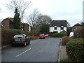
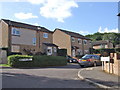
7
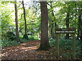
Entrance to Walderslade Woods
As seen from Tunbury Avenue.
A path leads through the woods (in a shallow valley) to Woodlands (lane), Beechen Bank.
Image: © David Anstiss
Taken: 14 Oct 2012
0.08 miles
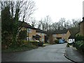
9
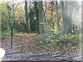
Entrance to Walderslade Woodlands
On Woodbury Road. Footpath leads to Walderslade Bottom.
Image: © David Anstiss
Taken: 11 Nov 2008
0.09 miles