IMAGES TAKEN NEAR TO
Bartlett Close, CHATHAM, ME5 8TX
Introduction
This page details the photographs taken nearby to Bartlett Close, ME5 8TX by members of the Geograph project.
The Geograph project started in 2005 with the aim of publishing, organising and preserving representative images for every square kilometre of Great Britain, Ireland and the Isle of Man.

There are currently over 7.5m images from over14,400 individuals and you can help contribute to the project by visiting https://www.geograph.org.uk
Image Map
Images are licensed for reuse under creativecommons.org/licenses/by-sa/2.0
Notes
- Clicking on the map will re-center to the selected point.
- The higher the marker number, the further away the image location is from the centre of the postcode.
Image Listing (45 Images Found)
Images are licensed for reuse under creativecommons.org/licenses/by-sa/2.0
Image
Details
Distance
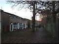
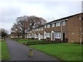
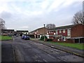
6
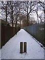
Coppertree Walk
This footpath leads from Badger Road, past Swingate Infant School to Sultan Road and Whimbrel Walk.
Image: © David Anstiss
Taken: 5 Jan 2010
0.06 miles
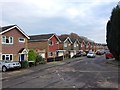
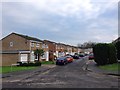
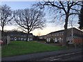
9
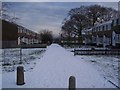
Bower Green
Close of houses off Tuscan Drive.
Image: © David Anstiss
Taken: 5 Jan 2010
0.08 miles