IMAGES TAKEN NEAR TO
Croydon Close, CHATHAM, ME5 8RT
Introduction
This page details the photographs taken nearby to Croydon Close, ME5 8RT by members of the Geograph project.
The Geograph project started in 2005 with the aim of publishing, organising and preserving representative images for every square kilometre of Great Britain, Ireland and the Isle of Man.

There are currently over 7.5m images from over14,400 individuals and you can help contribute to the project by visiting https://www.geograph.org.uk
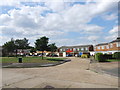
Image Map
Images are licensed for reuse under creativecommons.org/licenses/by-sa/2.0
Notes
- Clicking on the map will re-center to the selected point.
- The higher the marker number, the further away the image location is from the centre of the postcode.
Image Listing (35 Images Found)
Images are licensed for reuse under creativecommons.org/licenses/by-sa/2.0
Image
Details
Distance
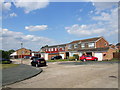
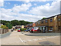
5
Kingston Crescent
Junction of Kingston Crescent and Shepperton Close, Lordswood.
Image: © Danny P Robinson
Taken: 9 Oct 2005
0.08 miles
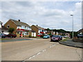
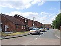
6
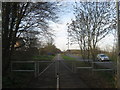
Squezegate on the Cyclepath towards Lordswood Lane
A cyclepath leads along North Dane Way (road on the right) from Albermarle Road.
Image: © David Anstiss
Taken: 24 Feb 2011
0.09 miles
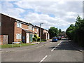
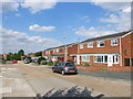
7
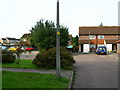
Shepperton Close, Lordswood
This quiet suburban cul de sac is typical of this particular area.
Image: © Danny P Robinson
Taken: 9 Oct 2005
0.09 miles