IMAGES TAKEN NEAR TO
Lords Wood Lane, CHATHAM, ME5 8NR
Introduction
This page details the photographs taken nearby to Lords Wood Lane, ME5 8NR by members of the Geograph project.
The Geograph project started in 2005 with the aim of publishing, organising and preserving representative images for every square kilometre of Great Britain, Ireland and the Isle of Man.

There are currently over 7.5m images from over14,400 individuals and you can help contribute to the project by visiting https://www.geograph.org.uk
Image Map
Images are licensed for reuse under creativecommons.org/licenses/by-sa/2.0
Notes
- Clicking on the map will re-center to the selected point.
- The higher the marker number, the further away the image location is from the centre of the postcode.
Image Listing (38 Images Found)
Images are licensed for reuse under creativecommons.org/licenses/by-sa/2.0
Image
Details
Distance
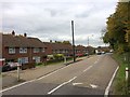
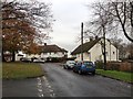
2
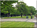
Green strip along Lordswood Lane
Looking across Ballens Road.
Image: © Robin Webster
Taken: 25 Jun 2012
0.04 miles
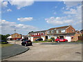
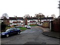
7
Shepperton Close, Lordswood
This quiet suburban cul de sac is typical of this particular area.
Image: © Danny P Robinson
Taken: 9 Oct 2005
0.12 miles
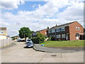
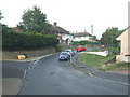
9
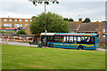
Lords Wood Lane School bus stop
A route 166 bus picks up a couple of senior citizens.
Image: © Robin Webster
Taken: 25 Jun 2012
0.13 miles