IMAGES TAKEN NEAR TO
Turnstone Road, CHATHAM, ME5 8NF
Introduction
This page details the photographs taken nearby to Turnstone Road, ME5 8NF by members of the Geograph project.
The Geograph project started in 2005 with the aim of publishing, organising and preserving representative images for every square kilometre of Great Britain, Ireland and the Isle of Man.

There are currently over 7.5m images from over14,400 individuals and you can help contribute to the project by visiting https://www.geograph.org.uk
Image Map
Images are licensed for reuse under creativecommons.org/licenses/by-sa/2.0
Notes
- Clicking on the map will re-center to the selected point.
- The higher the marker number, the further away the image location is from the centre of the postcode.
Image Listing (53 Images Found)
Images are licensed for reuse under creativecommons.org/licenses/by-sa/2.0
Image
Details
Distance
7
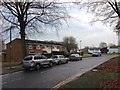
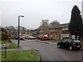
St David's Chapel, Lords Wood
On Kestrel Road in Kestrel Shopping Centre.
"Aims to be an oasis of peace in a busy world"
Image: © David Anstiss
Taken: 11 Nov 2008
0.08 miles
9
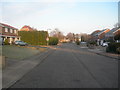
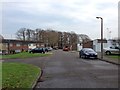
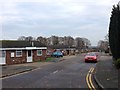
Lambourn Way, Lordswood
Taken near junction of Catterick Road
Image: © Danny P Robinson
Taken: 23 Mar 2006
0.09 miles
10
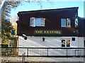
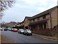
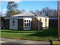
The Kestrel Public House, Lords Wood
On Kestrel Road, in Kestrel Shopping Centre.
Currently closed, for let for a new landlord/owner.
Flanked by two churches, so not surprising pub in trouble.
Image: © David Anstiss
Taken: 11 Nov 2008
0.09 miles