IMAGES TAKEN NEAR TO
Carlton Crescent, CHATHAM, ME5 7PH
Introduction
This page details the photographs taken nearby to Carlton Crescent, ME5 7PH by members of the Geograph project.
The Geograph project started in 2005 with the aim of publishing, organising and preserving representative images for every square kilometre of Great Britain, Ireland and the Isle of Man.

There are currently over 7.5m images from over14,400 individuals and you can help contribute to the project by visiting https://www.geograph.org.uk
Image Map
Images are licensed for reuse under creativecommons.org/licenses/by-sa/2.0
Notes
- Clicking on the map will re-center to the selected point.
- The higher the marker number, the further away the image location is from the centre of the postcode.
Image Listing (42 Images Found)
Images are licensed for reuse under creativecommons.org/licenses/by-sa/2.0
Image
Details
Distance
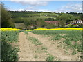
3
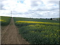
Footpath to North Dane Way
This path leads up from Capstone Road through an oilseed rape field towards the road.
In the background (on the far right) is Chatham.
Image: © David Anstiss
Taken: 8 May 2013
0.07 miles
5
Footpath to Capstone Road, Hale
A footpath leads through an oilseed rape field from North Dane Way towards Image (on the right) on Capstone Road.
Image: © David Anstiss
Taken: 8 May 2013
0.09 miles
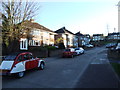
6
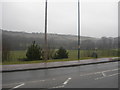
Luton Recreation Ground
The road in the foreground is Capstone Road, near the junction of North Dane Way. In the background, the ridge is part of Darland Banks.
Image: © Danny P Robinson
Taken: 24 Mar 2006
0.10 miles
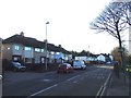
7
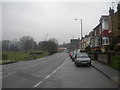
Capstone Road, Luton
There is a recreation ground to the left. Luton is a part of Chatham, as opposed to the town in Bedfordshire.
Image: © Danny P Robinson
Taken: 24 Mar 2006
0.10 miles
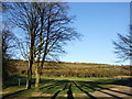
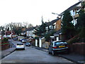
9
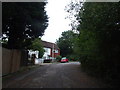
East Hill, Luton
This road use to lead from Capstone Road up to nearby Shawstead Road and Lords Wood Lane before the construction of North Dane Way in the 1970s.
Image: © Chris Whippet
Taken: 27 Aug 2010
0.11 miles
10
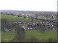
Luton Recreation Ground and Carlton Crescent, Chatham
Capstone Road runs left to right through the centre of the picture. Luton Recreation Ground is in the foreground, houses on Carlton Crescent are in the centre. To the background are the Walderslade and Princes Park areas. Picture taken from Kingsway, Darland.
Image: © Danny P Robinson
Taken: 19 Mar 2008
0.12 miles