IMAGES TAKEN NEAR TO
Osprey Avenue, CHATHAM, ME5 7HZ
Introduction
This page details the photographs taken nearby to Osprey Avenue, ME5 7HZ by members of the Geograph project.
The Geograph project started in 2005 with the aim of publishing, organising and preserving representative images for every square kilometre of Great Britain, Ireland and the Isle of Man.

There are currently over 7.5m images from over14,400 individuals and you can help contribute to the project by visiting https://www.geograph.org.uk
Image Map
Images are licensed for reuse under creativecommons.org/licenses/by-sa/2.0
Notes
- Clicking on the map will re-center to the selected point.
- The higher the marker number, the further away the image location is from the centre of the postcode.
Image Listing (89 Images Found)
Images are licensed for reuse under creativecommons.org/licenses/by-sa/2.0
Image
Details
Distance
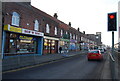
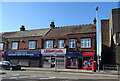
3
Gillingham Nisa Local
This building on the junction of the A2 Watling Street and Derby Road used to be a Nationwide Bank. Closed for several years, now about to re-open as a local supermarket.
Image: © David Anstiss
Taken: 23 Jun 2012
0.03 miles
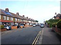
4
Watling Street, Gillingham/ Chatham borders
Image: © Chris Whippet
Taken: 16 Aug 2010
0.04 miles
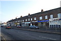
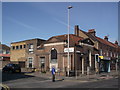
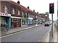
10
Businesses on Watling Street (A2), Gillingham
Image: © JThomas
Taken: 22 Jun 2022
0.05 miles