IMAGES TAKEN NEAR TO
Hunters Way West, CHATHAM, ME5 7HN
Introduction
This page details the photographs taken nearby to Hunters Way West, ME5 7HN by members of the Geograph project.
The Geograph project started in 2005 with the aim of publishing, organising and preserving representative images for every square kilometre of Great Britain, Ireland and the Isle of Man.

There are currently over 7.5m images from over14,400 individuals and you can help contribute to the project by visiting https://www.geograph.org.uk
Image Map
Images are licensed for reuse under creativecommons.org/licenses/by-sa/2.0
Notes
- Clicking on the map will re-center to the selected point.
- The higher the marker number, the further away the image location is from the centre of the postcode.
Image Listing (107 Images Found)
Images are licensed for reuse under creativecommons.org/licenses/by-sa/2.0
Image
Details
Distance
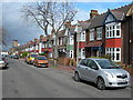
2
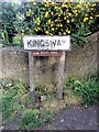
Vintage street nameplate, Kingsway, Chatham
Image: © Chris Whippet
Taken: 11 May 2016
0.02 miles
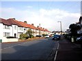
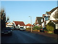
5
Beechwood Avenue, Gillingham
Looking towards Watling Street.
Image: © Danny P Robinson
Taken: 19 Mar 2008
0.06 miles
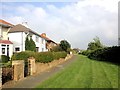
8
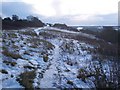
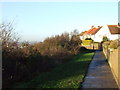
Footpath across the Darland Banks, Winter 2009
This ice and snow covered path leads from Ash Tree Lane towards Kingsway. The Capstone valley is on the right.
Image: © David Anstiss
Taken: 24 Dec 2009
0.09 miles
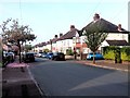
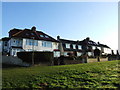
9
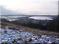
View of the Capstone Valley, Winter 2009
Seen from the footpath on Darland Banks.
Image: © David Anstiss
Taken: 24 Dec 2009
0.09 miles