IMAGES TAKEN NEAR TO
Coronation Road, CHATHAM, ME5 7DD
Introduction
This page details the photographs taken nearby to Coronation Road, ME5 7DD by members of the Geograph project.
The Geograph project started in 2005 with the aim of publishing, organising and preserving representative images for every square kilometre of Great Britain, Ireland and the Isle of Man.

There are currently over 7.5m images from over14,400 individuals and you can help contribute to the project by visiting https://www.geograph.org.uk
Image Map (Loading...)


Getting Data...Please wait
Leaflet Map data © OpenStreetMap
Images are licensed for reuse under creativecommons.org/licenses/by-sa/2.0
Notes
- Clicking on the map will re-center to the selected point.
- The higher the marker number, the further away the image location is from the centre of the postcode.
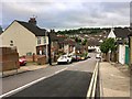
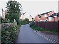
Image Listing (100 Images Found)
Images are licensed for reuse under creativecommons.org/licenses/by-sa/2.0
Image
Details
Distance

9
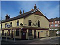
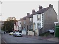
Brickmaker's Arms Public House, Luton
On junction of Luton Road and Ambrose Hill.
Closed for re-development.
Image: © David Anstiss
Taken: 7 Nov 2008
0.11 miles
10
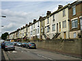
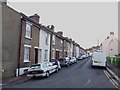
Houses on Upper Luton Road
The road is still not upper enough to be level with this side of the road.
Image: © Robin Webster
Taken: 25 Jun 2012
0.11 miles