IMAGES TAKEN NEAR TO
Ordnance Street, CHATHAM, ME4 6SD
Introduction
This page details the photographs taken nearby to Ordnance Street, ME4 6SD by members of the Geograph project.
The Geograph project started in 2005 with the aim of publishing, organising and preserving representative images for every square kilometre of Great Britain, Ireland and the Isle of Man.

There are currently over 7.5m images from over14,400 individuals and you can help contribute to the project by visiting https://www.geograph.org.uk
Image Map
Images are licensed for reuse under creativecommons.org/licenses/by-sa/2.0
Notes
- Clicking on the map will re-center to the selected point.
- The higher the marker number, the further away the image location is from the centre of the postcode.
Image Listing (103 Images Found)
Images are licensed for reuse under creativecommons.org/licenses/by-sa/2.0
Image
Details
Distance
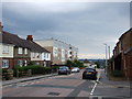
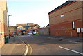
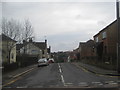
5
Mozart Court
Leading of Ordnance Street.
Image: © David Anstiss
Taken: 23 Feb 2010
0.04 miles
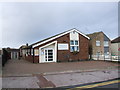
6
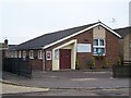
Chatham Evangelical Church
On (138-140) Ordnance Street.
Image: © David Anstiss
Taken: 17 Nov 2008
0.04 miles
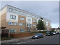
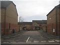
8
Corkwell Street
This street leads from Ordnance Street to Dale Street, crossing Pagitt Street and Rochester Street.
Image: © David Anstiss
Taken: 23 Feb 2010
0.05 miles
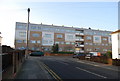
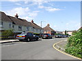
9

Blenheim Avenue meets Grosvenor Avenue
Postbox number ME4 6 is at the corner, a George VI model.
Image: © Robin Webster
Taken: 25 Jun 2012
0.05 miles