IMAGES TAKEN NEAR TO
Maidstone Road, CHATHAM, ME4 6HY
Introduction
This page details the photographs taken nearby to Maidstone Road, ME4 6HY by members of the Geograph project.
The Geograph project started in 2005 with the aim of publishing, organising and preserving representative images for every square kilometre of Great Britain, Ireland and the Isle of Man.

There are currently over 7.5m images from over14,400 individuals and you can help contribute to the project by visiting https://www.geograph.org.uk
Image Map
Images are licensed for reuse under creativecommons.org/licenses/by-sa/2.0
Notes
- Clicking on the map will re-center to the selected point.
- The higher the marker number, the further away the image location is from the centre of the postcode.
Image Listing (41 Images Found)
Images are licensed for reuse under creativecommons.org/licenses/by-sa/2.0
Image
Details
Distance
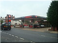
1
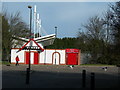
Chatham Town Football Club
Picture taken from car park off Bournville Avenue.
Image: © Danny P Robinson
Taken: 24 Feb 2008
0.03 miles
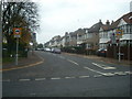
6
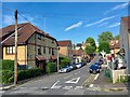
Letchworth Avenue, Chatham
You might just be able to spot the entrance of Chatham Grammar School for Boys on the right. Houses on left are substantial 1930s houses.
Image: © Danny P Robinson
Taken: 30 Aug 2005
0.07 miles
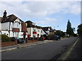
7
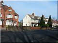
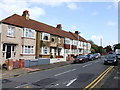
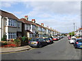
Houses on Maidstone Road, Chatham
Near the junction with Randall Road.
Image: © Danny P Robinson
Taken: 24 Feb 2008
0.07 miles