
IMAGES TAKEN NEAR TO
Restharrow Way, CHATHAM, ME4 3HR
Introduction
This page details the photographs taken nearby to Restharrow Way, ME4 3HR by members of the Geograph project.
The Geograph project started in 2005 with the aim of publishing, organising and preserving representative images for every square kilometre of Great Britain, Ireland and the Isle of Man.

There are currently over 7.5m images from over14,400 individuals and you can help contribute to the project by visiting https://www.geograph.org.uk
Image Map
Images are licensed for reuse under creativecommons.org/licenses/by-sa/2.0
Notes
- Clicking on the map will re-center to the selected point.
- The higher the marker number, the further away the image location is from the centre of the postcode.
Image Listing (82 Images Found)
Images are licensed for reuse under creativecommons.org/licenses/by-sa/2.0
Image
Details
Distance
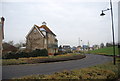
3
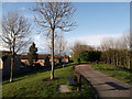
Path, St Mary's Island
This path leads on top of a bund (a manmade earthbank). This earthbank protects the houses on the left from noises from the Chatham Dockyard. (See Image).
The path is part of circular walk around the island. It heads towards the riverside walk beside the River Medway.
Image: © David Anstiss
Taken: 17 Apr 2012
0.08 miles
4
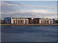
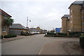
Two large apartment blocks, St Mary's Island
Looking across Basin 2, Chatham Maritime towards two large housing blocks on Restharrow Way on the island.
Image: © David Anstiss
Taken: 17 Apr 2012
0.09 miles
6
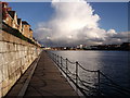
Boardwalk, Basin 2, Chatham Maritime
This floating walkway leads from Maritime Avenue (the main road leading to the island) to a pontoon walkway beside the former dock. It is part of a walkway around the island.
In the background is Chatham Docks (around Basin 3).
Image: © David Anstiss
Taken: 17 Apr 2012
0.13 miles
8
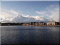
Basin 2, Chatham Maritime
One of the former docks of Chatham Navy Docks.
After 1984, St Mary's Island was developed a residential community for some 1,500 homes.
Image: © David Anstiss
Taken: 17 Apr 2012
0.14 miles
10
Cranes and ship, Chatham Docks
Looking at a large ship moored alongside the Northside of Basin 3 of the former Navy Dockyard.
Image: © David Anstiss
Taken: 17 Apr 2012
0.14 miles