IMAGES TAKEN NEAR TO
Egret Close, CHATHAM, ME4 3EG
Introduction
This page details the photographs taken nearby to Egret Close, ME4 3EG by members of the Geograph project.
The Geograph project started in 2005 with the aim of publishing, organising and preserving representative images for every square kilometre of Great Britain, Ireland and the Isle of Man.

There are currently over 7.5m images from over14,400 individuals and you can help contribute to the project by visiting https://www.geograph.org.uk
Image Map
Images are licensed for reuse under creativecommons.org/licenses/by-sa/2.0
Notes
- Clicking on the map will re-center to the selected point.
- The higher the marker number, the further away the image location is from the centre of the postcode.
Image Listing (137 Images Found)
Images are licensed for reuse under creativecommons.org/licenses/by-sa/2.0
Image
Details
Distance
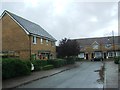
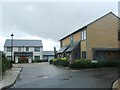
3
Island Road West
The large building, in the distance, is Image, an apartment block comprised of 24, 2 bedroom units for people over 55. The hoarding, along its frontage, indicates that it is still under construction.
Image: © John Baker
Taken: 9 May 2018
0.04 miles
5
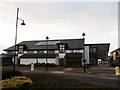
St Mary's Island Community Centre
On Island Way West.
The small island pharmacy is on the right of the centre.
Image: © David Anstiss
Taken: 17 Apr 2012
0.05 miles
6
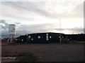
Sunset over a development site, St Mary's Island
As seen from Samphire Way.
This is part of the Riverside Quarter development by Countryside Properties.
Image: © David Anstiss
Taken: 17 Apr 2012
0.06 miles
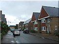
7
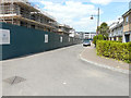
Samphire Way
This image of Image was taken before construction of the houses, on the left, had started.
Image: © John Baker
Taken: 9 May 2018
0.06 miles
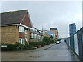
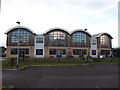
8
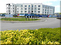
Atlas Place
This is an apartment block comprised of 24, 2 bedroom units for people over 55. Words on the hoarding read that this is the fantastic final development on St Mary’s Island. The presence of scaffolding, on the left side of the block, indicates that it is still under construction.
Image: © John Baker
Taken: 9 May 2018
0.06 miles
10
St Mary's Island Primary School (2)
Church of England Primary School on Island Way West.
Seen across the car park.
Image: © David Anstiss
Taken: 17 Apr 2012
0.09 miles