IMAGES TAKEN NEAR TO
Westview, CHATHAM, ME4 3AD
Introduction
This page details the photographs taken nearby to Westview, ME4 3AD by members of the Geograph project.
The Geograph project started in 2005 with the aim of publishing, organising and preserving representative images for every square kilometre of Great Britain, Ireland and the Isle of Man.

There are currently over 7.5m images from over14,400 individuals and you can help contribute to the project by visiting https://www.geograph.org.uk
Image Map
Images are licensed for reuse under creativecommons.org/licenses/by-sa/2.0
Notes
- Clicking on the map will re-center to the selected point.
- The higher the marker number, the further away the image location is from the centre of the postcode.
Image Listing (71 Images Found)
Images are licensed for reuse under creativecommons.org/licenses/by-sa/2.0
Image
Details
Distance
2
Housing on Westview, St Mary's Island
Looking northwards at the new housing on the island.
Henrietta Chase is on the right.
Image: © David Anstiss
Taken: 22 Jul 2013
0.02 miles
3
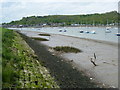
Upnor Reach from St Mary's Island
St Mary's Island, is part of the Chatham Maritime development area. By 1854, the whole of the island was in the hands of the Crown and the Royal Dockyard, Chatham. During the later years of the Royal Navy's time in occupation the area had consisted of a mixture of sports fields and warehousing. St.Mary's Island is divided from mainland Chatham by three basins used by the Dockyard.
In 1984, the Dockyard was closed. In the late 1990s, English Partnerships and housing developer Countryside, came together to build homes on the island, under the development name Countryside Maritime. There are areas of raised parkland, but the real draw here are the views of the Medway Estuary opposite Lower Upnor and Hoo St Werburgh. In this view Lower Upnor is straight ahead on the other side of the river.
For more information see http://en.wikipedia.org/wiki/St_Mary's_Island,_Medway
Image: © Marathon
Taken: 24 Apr 2014
0.04 miles
4

Little Victory Mount, St. Mary's Island
Image: © Chris Whippet
Taken: 24 Aug 2015
0.05 miles
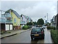
6
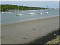
View from the riverfront at St Mary's Island
St Mary's Island, is part of the Chatham Maritime development area. By 1854, the whole of the island was in the hands of the Crown and the Royal Dockyard, Chatham. During the later years of the Royal Navy's time in occupation the area had consisted of a mixture of sports fields and warehousing. St.Mary's Island is divided from mainland Chatham by three basins used by the Dockyard.
In 1984, the Dockyard was closed. In the late 1990s, English Partnerships and housing developer Countryside, came together to build homes on the island, under the development name Countryside Maritime. There are areas of raised parkland, but the real draw here are the views of the Medway Estuary opposite Lower Upnor and Hoo St Werburgh. In this view Port Werburgh and Hoo Marina Park are on the right with the chimney of Kingsnorth Power Station looming behind.
For more information see http://en.wikipedia.org/wiki/St_Mary's_Island,_Medway
Image: © Marathon
Taken: 24 Apr 2014
0.06 miles
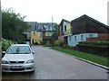

9
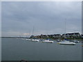
Shipping Lane. St Mary's Island
In the River Medway north of Chatham Dockyard
Image: © Paul Gillett
Taken: 21 Jul 2011
0.08 miles