IMAGES TAKEN NEAR TO
Heron Way, ROCHESTER, ME3 9SU
Introduction
This page details the photographs taken nearby to Heron Way, ME3 9SU by members of the Geograph project.
The Geograph project started in 2005 with the aim of publishing, organising and preserving representative images for every square kilometre of Great Britain, Ireland and the Isle of Man.

There are currently over 7.5m images from over14,400 individuals and you can help contribute to the project by visiting https://www.geograph.org.uk
Image Map
Images are licensed for reuse under creativecommons.org/licenses/by-sa/2.0
Notes
- Clicking on the map will re-center to the selected point.
- The higher the marker number, the further away the image location is from the centre of the postcode.
Image Listing (98 Images Found)
Images are licensed for reuse under creativecommons.org/licenses/by-sa/2.0
Image
Details
Distance
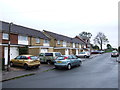
1
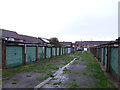
Service Road between Mallard Way and Heron Way, Lower Stoke
Image: © Chris Whippet
Taken: 10 Nov 2013
0.03 miles
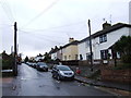
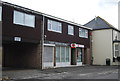
8
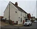
House and shops on High Street, Lower Stoke
Showing position of Postbox No. ME3 199.
See Image] for postbox.
Image: © JThomas
Taken: 23 Jun 2022
0.06 miles
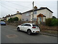
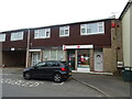
9
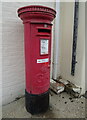
George V postbox on High Street, Lower Stoke
Postbox No. ME3 199.
See Image] for context.
Image: © JThomas
Taken: 23 Jun 2022
0.06 miles