IMAGES TAKEN NEAR TO
Stoke Road, ROCHESTER, ME3 9BJ
Introduction
This page details the photographs taken nearby to Stoke Road, ME3 9BJ by members of the Geograph project.
The Geograph project started in 2005 with the aim of publishing, organising and preserving representative images for every square kilometre of Great Britain, Ireland and the Isle of Man.

There are currently over 7.5m images from over14,400 individuals and you can help contribute to the project by visiting https://www.geograph.org.uk
Image Map
Images are licensed for reuse under creativecommons.org/licenses/by-sa/2.0
Notes
- Clicking on the map will re-center to the selected point.
- The higher the marker number, the further away the image location is from the centre of the postcode.
Image Listing (19 Images Found)
Images are licensed for reuse under creativecommons.org/licenses/by-sa/2.0
Image
Details
Distance
4
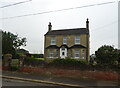
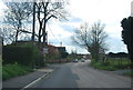
Dencher
House on Stoke Road, Hoo St Werburgh.
Image: © JThomas
Taken: 23 Jun 2022
0.06 miles
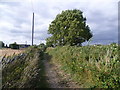
5
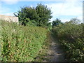
The Saxon Shore Way near Hoo St Werburgh
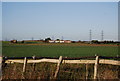
The Saxon Shore Way follows Kent's ancient coastline. In many places this is now miles inland. The Saxon Shore Way is named after the line of historic fortifications that defended the Kent coast at the end of the Roman era. It is 160 miles long and runs from Gravesend to Hastings.
Here it is heading away from the edge of Hoo St Werburgh towards the Medway Estuary at Hoo Flats and Rochester.
Image: © Marathon
Taken: 15 Aug 2013
0.08 miles
8
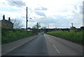
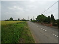
The Saxon Shore Way near Hoo St Werburgh
The Saxon Shore Way follows Kent's ancient coastline. In many places this is now miles inland. The Saxon Shore Way is named after the line of historic fortifications that defended the Kent coast at the end of the Roman era. It is 160 miles long and runs from Gravesend to Hastings.
Here it is heading from the Medway Estuary at Hoo Flats up to the edge of Hoo St Werburgh.
Image: © Marathon
Taken: 15 Aug 2013
0.12 miles
9
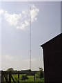
Hoo Arqiva MF-Mast
This is another mast on this Grain peninsula within the area around Hoo.
This one belongs to Arqiva and Transmits Capital Gold.
Image: © David Neale
Taken: Unknown
0.12 miles