IMAGES TAKEN NEAR TO
Marsh Crescent, ROCHESTER, ME3 8TJ
Introduction
This page details the photographs taken nearby to Marsh Crescent, ME3 8TJ by members of the Geograph project.
The Geograph project started in 2005 with the aim of publishing, organising and preserving representative images for every square kilometre of Great Britain, Ireland and the Isle of Man.

There are currently over 7.5m images from over14,400 individuals and you can help contribute to the project by visiting https://www.geograph.org.uk
Image Map
Images are licensed for reuse under creativecommons.org/licenses/by-sa/2.0
Notes
- Clicking on the map will re-center to the selected point.
- The higher the marker number, the further away the image location is from the centre of the postcode.
Image Listing (35 Images Found)
Images are licensed for reuse under creativecommons.org/licenses/by-sa/2.0
Image
Details
Distance
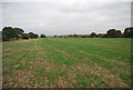
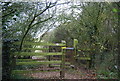
2
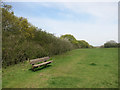
Not the Saxon Shore Way
Parallel to it but just a few metres away on the other side of the hedge. This is a patch of grassland on the edge of High Halstow that looks like it's used by local people for dog walking etc.
Image: © Des Blenkinsopp
Taken: 21 Apr 2016
0.05 miles
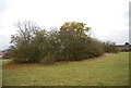
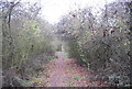
7
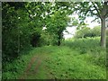
Footpath, Northward Hill Nature Reserve
Image: © Chris Whippet
Taken: 26 May 2016
0.10 miles