IMAGES TAKEN NEAR TO
Bull Lane, ROCHESTER, ME3 7LT
Introduction
This page details the photographs taken nearby to Bull Lane, ME3 7LT by members of the Geograph project.
The Geograph project started in 2005 with the aim of publishing, organising and preserving representative images for every square kilometre of Great Britain, Ireland and the Isle of Man.

There are currently over 7.5m images from over14,400 individuals and you can help contribute to the project by visiting https://www.geograph.org.uk
Image Map
Images are licensed for reuse under creativecommons.org/licenses/by-sa/2.0
Notes
- Clicking on the map will re-center to the selected point.
- The higher the marker number, the further away the image location is from the centre of the postcode.
Image Listing (30 Images Found)
Images are licensed for reuse under creativecommons.org/licenses/by-sa/2.0
Image
Details
Distance
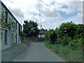
3

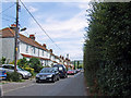
Church Street, Higham
Church Street is a country lane leading out of the village of Higham in Kent.
Image: © Malc McDonald
Taken: 23 Feb 2019
0.08 miles
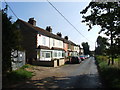
6
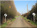
Church Street, Higham
National speed limit signs on Church Street, heading out of the village of Higham in Kent.
Image: © Malc McDonald
Taken: 23 Feb 2019
0.11 miles
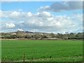
9
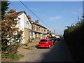
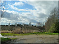
Orchard near Lower Higham
Orchards occupy a fair acreage on the Hoo peninsula, generally on the higher ground. This one lies south of Church Street village. The view is south, towards houses in Bull Lane.
Image: © Stefan Czapski
Taken: 8 May 2012
0.13 miles
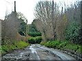
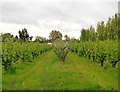
10
Orchard off Church Street
A surviving orchard, although looking a bit neglected.
Image: © Robin Webster
Taken: 7 Feb 2014
0.14 miles