IMAGES TAKEN NEAR TO
Brice Road, ROCHESTER, ME3 7AB
Introduction
This page details the photographs taken nearby to Brice Road, ME3 7AB by members of the Geograph project.
The Geograph project started in 2005 with the aim of publishing, organising and preserving representative images for every square kilometre of Great Britain, Ireland and the Isle of Man.

There are currently over 7.5m images from over14,400 individuals and you can help contribute to the project by visiting https://www.geograph.org.uk
Image Map
Images are licensed for reuse under creativecommons.org/licenses/by-sa/2.0
Notes
- Clicking on the map will re-center to the selected point.
- The higher the marker number, the further away the image location is from the centre of the postcode.
Image Listing (78 Images Found)
Images are licensed for reuse under creativecommons.org/licenses/by-sa/2.0
Image
Details
Distance
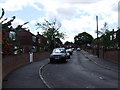
3

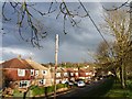
Villa Road, Higham
Towards the village centre.
Image: © Robin Webster
Taken: 24 Feb 2019
0.06 miles
10
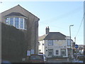
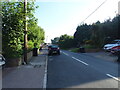
Gardeners Arms, Higham
A pub at the crossroads in the middle of Higham Village.
Image: © Stephen Craven
Taken: 27 Jan 2007
0.11 miles