IMAGES TAKEN NEAR TO
Teal Close, ROCHESTER, ME3 0DL
Introduction
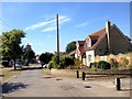
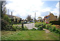
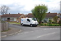
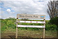
This page details the photographs taken nearby to Teal Close, ME3 0DL by members of the Geograph project.
The Geograph project started in 2005 with the aim of publishing, organising and preserving representative images for every square kilometre of Great Britain, Ireland and the Isle of Man.

There are currently over 7.5m images from over14,400 individuals and you can help contribute to the project by visiting https://www.geograph.org.uk
Image Map
Images are licensed for reuse under creativecommons.org/licenses/by-sa/2.0
Notes
- Clicking on the map will re-center to the selected point.
- The higher the marker number, the further away the image location is from the centre of the postcode.
Image Listing (118 Images Found)
Images are licensed for reuse under creativecommons.org/licenses/by-sa/2.0
Image
Details
Distance
10
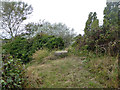
Gun mounting, Grain Fort
A WWII gun mounting on the rampart of the Victorian fort, which is now demolished apart from heavily scrubbed earthworks and some associated retaining walls. The rail beyond the gun mounting guards a large drop over one of these walls.
Image: © Robin Webster
Taken: 15 Oct 2016
0.06 miles