IMAGES TAKEN NEAR TO
Woodstock Road, ROCHESTER, ME2 2DG
Introduction
This page details the photographs taken nearby to Woodstock Road, ME2 2DG by members of the Geograph project.
The Geograph project started in 2005 with the aim of publishing, organising and preserving representative images for every square kilometre of Great Britain, Ireland and the Isle of Man.

There are currently over 7.5m images from over14,400 individuals and you can help contribute to the project by visiting https://www.geograph.org.uk
Image Map (Loading...)


Getting Data...Please wait
Leaflet Map data © OpenStreetMap
Images are licensed for reuse under creativecommons.org/licenses/by-sa/2.0
Notes
- Clicking on the map will re-center to the selected point.
- The higher the marker number, the further away the image location is from the centre of the postcode.
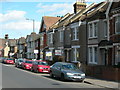
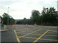
Image Listing (88 Images Found)
Images are licensed for reuse under creativecommons.org/licenses/by-sa/2.0
Image
Details
Distance
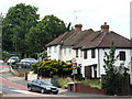
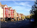
2
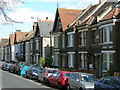
Houses on Northcote Road, Strood (1)
Image: © Danny P Robinson
Taken: 8 Mar 2009
0.07 miles
3
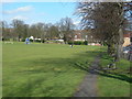
Northcote Road Recreation Ground, Strood
Image: © Danny P Robinson
Taken: 8 Mar 2009
0.07 miles
5

Vintage street nameplate, London Road, Strood
Image: © Chris Whippet
Taken: 23 Mar 2014
0.10 miles
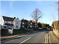
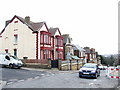
6
Houses on Northcote Road, Strood (2)
Image: © Danny P Robinson
Taken: 8 Mar 2009
0.10 miles
9
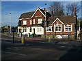
Coach and Horse Public House, Strood
On traffic light junction of 40 London Road (A2) and Gravesend Road.
Image: © David Anstiss
Taken: 19 Nov 2008
0.11 miles