IMAGES TAKEN NEAR TO
Queenswood Road, AYLESFORD, ME20 7EX
Introduction
This page details the photographs taken nearby to Queenswood Road, ME20 7EX by members of the Geograph project.
The Geograph project started in 2005 with the aim of publishing, organising and preserving representative images for every square kilometre of Great Britain, Ireland and the Isle of Man.

There are currently over 7.5m images from over14,400 individuals and you can help contribute to the project by visiting https://www.geograph.org.uk
Image Map
Images are licensed for reuse under creativecommons.org/licenses/by-sa/2.0
Notes
- Clicking on the map will re-center to the selected point.
- The higher the marker number, the further away the image location is from the centre of the postcode.
Image Listing (60 Images Found)
Images are licensed for reuse under creativecommons.org/licenses/by-sa/2.0
Image
Details
Distance
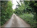
4
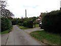
Chatham Road meets Old Chatham Road
Chatham Road (on the right) heads from Rochester Road up to the A229 Dual Carriageway. Old Chatham Road (on the left) passes several works buildings, before meeting Chatham Road. The North Downs Way (long distance path) passes this junction heading towards Kit's Coty House.
Image: © David Anstiss
Taken: 24 Dec 2009
0.07 miles
10
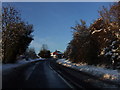
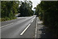
Old Chatham Road, near Blue Bell Hill
Image: © Chris Whippet
Taken: 19 Dec 2009
0.12 miles